Google has recently cobbled together interactive, panoramic images of historic locations in Antarctica using its Street View technology, pseudo-first-person views of locations around the world that are made available to users of Google Maps and Google Earth.
(Make sure to check out TIME’s interactive panorama of the inside of early Antarctic explorer Ernest Shackleton’s hut.)
So how does Google go about capturing all the images used for its Street View feature? Here are some of the tools and vehicles behind the immersive scenery.
The Camera

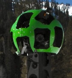
For Google to create a 360-degree image of a certain area, it basically needs to snap multiple photos from multiple angles at the same time. To do this with the Street View Car (more on that below), it uses a camera apparatus with “15 lenses taking 360 degrees of photos.”
Each lens snaps a photo that overlaps somewhat with the two lenses on either side of it, and then the resulting images are stitched together into a panoramic shot.
Google says, “We know the geometry of all of the different cameras in the system, and from that we determine where in the images we should ‘stitch’ to create a unified panorama. We then apply special image processing algorithms to lessen ‘seams’ where the images meet and create a smooth transition.”
So something like this series of photos…

Gets stitched into this panorama…

And eventually ends up on Google Maps like so:

If you were to navigate to the above location in Google Maps (click here), you’d be able to drag your mouse left and right to pan around the scene as though you were standing there.
The Street View Car
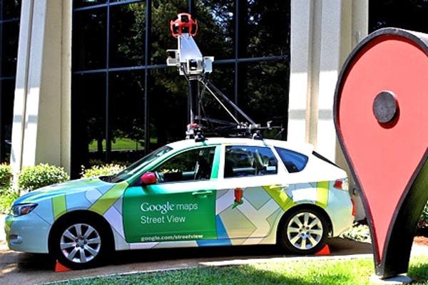
Google’s Street View Cars have been responsible for collecting much of the Street View imagery over the years. “When we first started Street View as an experimental project, we packed several computers into the back of an SUV, stuck cameras, lasers, and a GPS device on top, and drove around collecting our first imagery,” says Google. The first five U.S. cities launched in 2007.

Today, Google uses a fleet of cars equipped with Street View cameras: “After several iterations of the car and camera technology, the latest car has 15 lenses taking 360 degrees of photos. It also has motion sensors to track its position, a hard drive to store data, a small computer running the system, and lasers to capture 3D data to determine distances within the Street View imagery.”
The Street View Trike
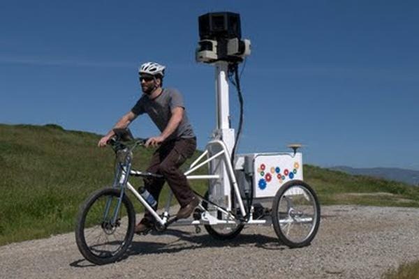
For places not quite accessible by car but still expansive enough that walking around on foot would take far too long to capture everything, Google uses the Street View Trike.

Google uses the Street View Trike to capture imagery from “parks and trails, university campuses and even sports stadiums.” The trike was used to capture Stonehenge back in 2011.
The Street View Trolley
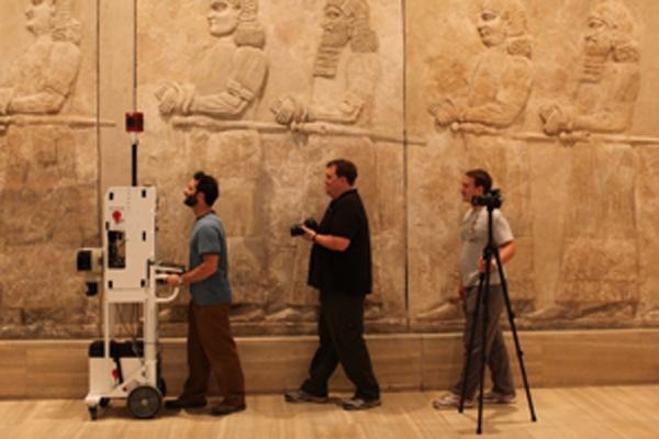
Mainly used for mapping the indoors of large buildings, the Street View Trolley is more or less a push-cart equipped with the gear needed to grab 360-degree imagery.

The Street View Trolley has most often been used to map the insides of museums as part of the Google Art Project. “We needed to develop a system that could easily fit through museum doorways and navigate around sculptures,” says Google.

